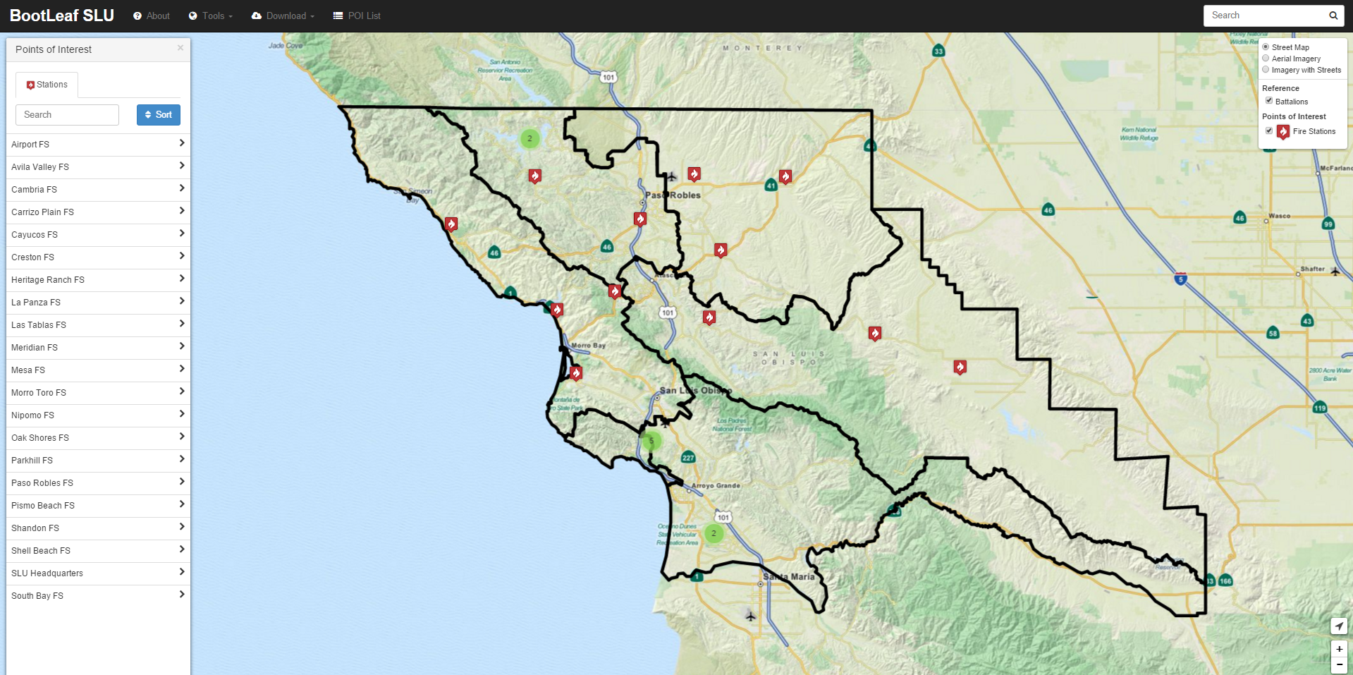
BootLeafSLU
Github
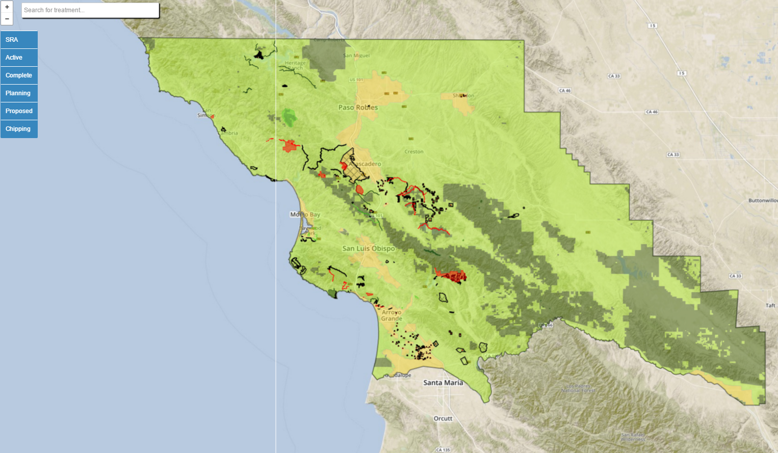
CalMAPPER
Github
Note: This project was last updated in 2015, the information may not be up to date.
Leaflet map showing fuel reduction treatments in SLO County. Select between completed, planning, or proposed treatments and chipping piles.Fire Fatalities
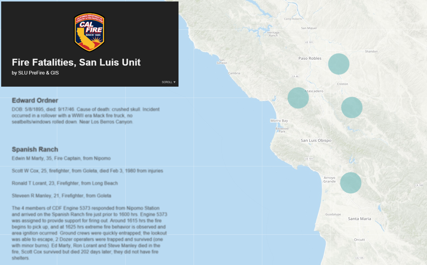
Github
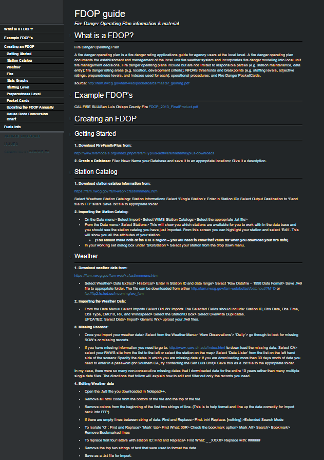
Fire Danger Operating Plan
Github
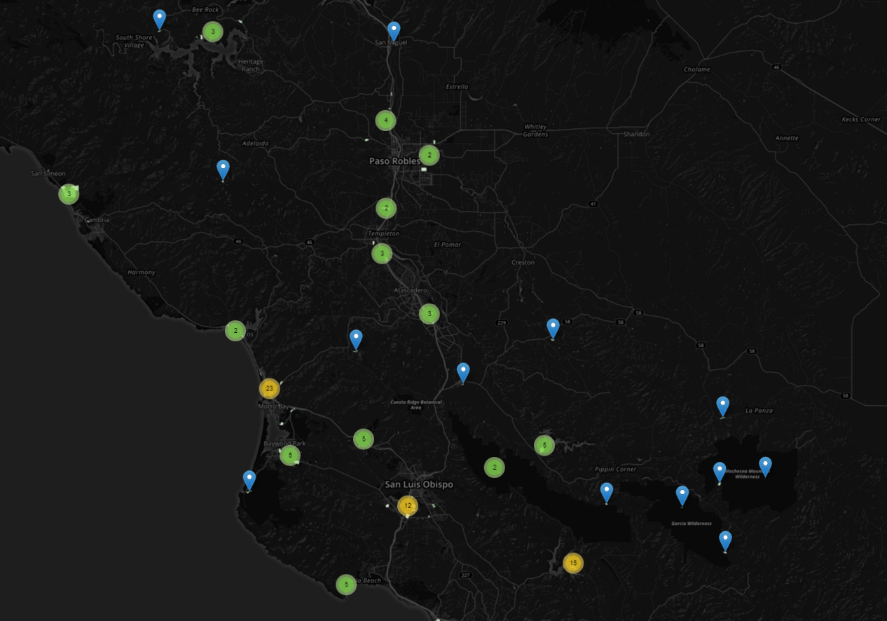
FCC Communication Towers
Project on Mapbox
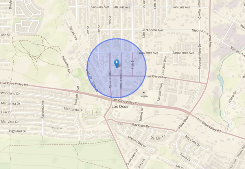
Mobile Homes, RV and Camp Sites
Github
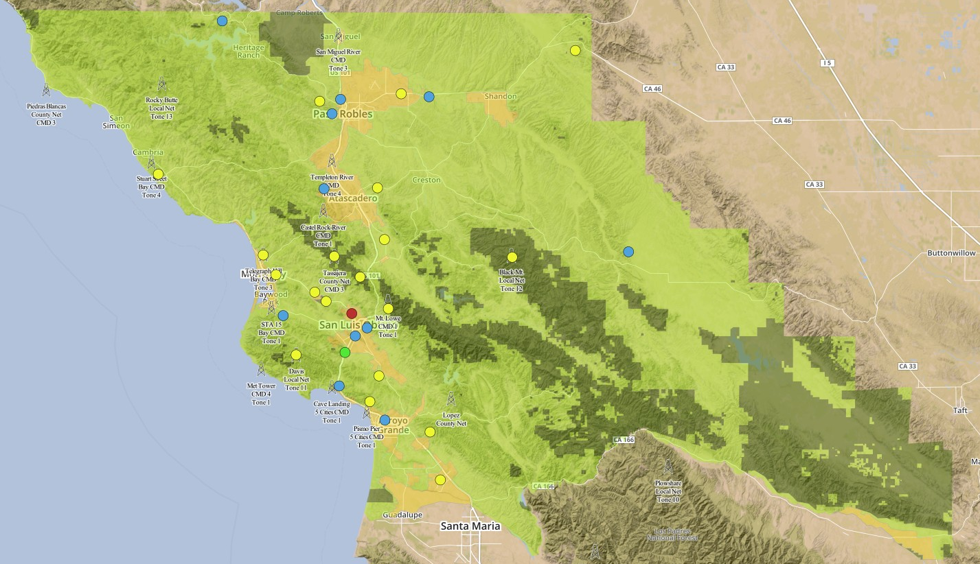
Radio Coverage
Github
Safe Refuge Areas
Project on Mapbox

Water Purveyors
Project on Carto
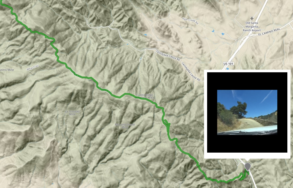
West Cuesta Video Map
Github
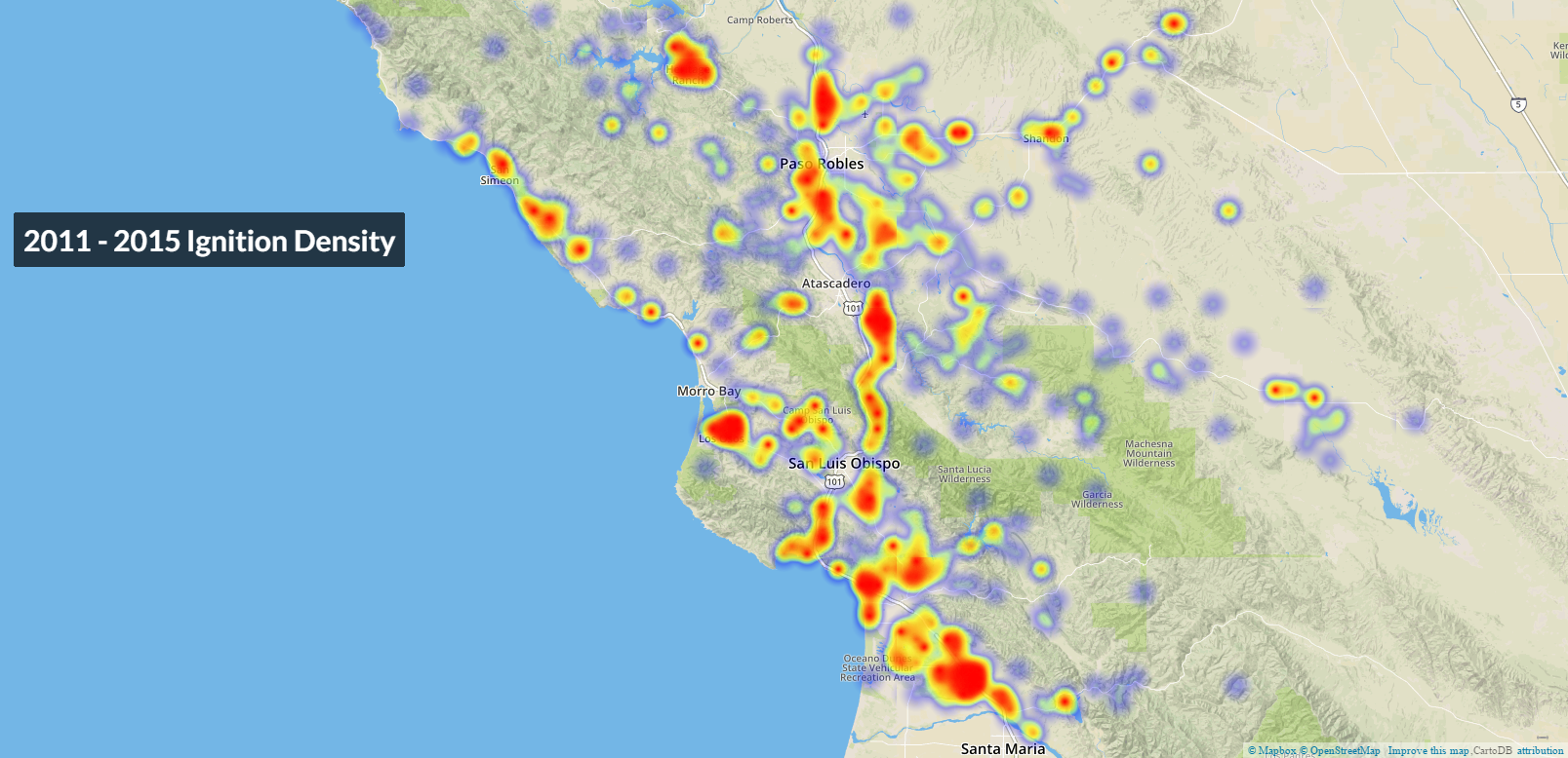
5-Year Ignitions
Project on Cartodb
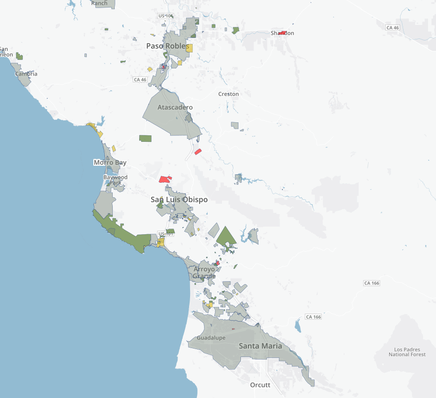
Tree Mortality
Project on Mapbox
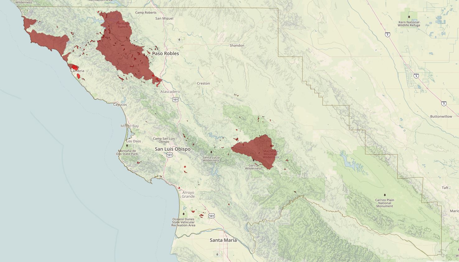
CA Fire History
Github
