Coastal
Inland
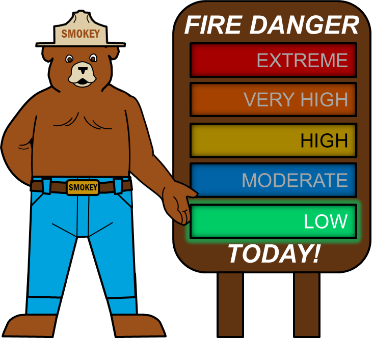
This site pulls data from the WIMS Data Exchange Facility, the data uses Ignition Component and Staffing Levels to calculate an adjective fire danger rating for the different areas. This is more commonly known as Fire Danger and is denoted by Smokey the Bear's arm.
The Coastal Smokey Bear uses data from the San Luis Obispo Remote Automated Weather Station while the Inland Smokey bear uses data from the Las Tablas Remote Automated Weather Station. Smokey's arm points to the calculated adjective fire danger rating for the separate coastal and inland areas.
Adjective Fire Danger Rating Map
Below shows a graph of the available San Luis Obispo County Remote Automated Weather Stations. Each circle represents a station and its color denotes the adjective fire danger rating of the area surrounding it.
Adjective Fire Danger Rating History
Shown below are the adjective fire ratings for the past 30 and 90 days. The graphs show the 4 stations typically used in the Fire Danger Operating Plan(FDOP). La Panza and Las Tablas are considered inland stations while San Simeon and San Luis Obispo would be considered coastal stations.